WOOOO-WEEEEEE
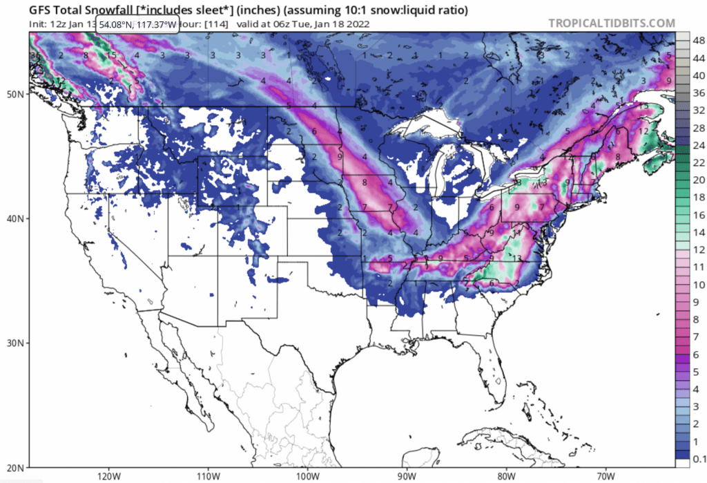
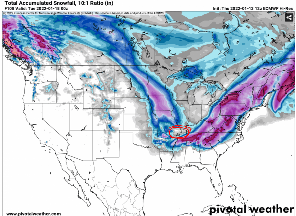
I am writing this as of 3:00 PM EST on January 13th, 2022. I typically wouldn’t start blogging about a specific storm unless it’s within a few days of the event. I think the eastern half of the United States is in for quite the snow maker! We’ll get to the snow for the Upper Valley in a moment, but let’s check out some of the snowfall projections for the south. Let’s compare the models.
Here’s the GFS: (The American Model)
Here’s the ECMWF snowfall projection (The European Model):
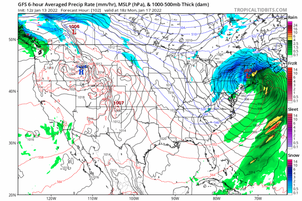
Now let’s check out what the storm placement should look like for the Upper Valley! Here’s the GFS:
Here’s the EURO for comparison:
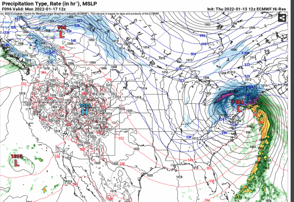
Either way, I think this will be a whopper of storm system for New England and parts of the Mid-Atlantic.
I will also be using this blog to hold myself accountable…. I am going to predict (as of 1/13) the snow measurement as of 1/17/22 at 5PM EST will be 7.2″ We’ll just have to see!
I will frequently post when new information becomes available, but this thing WILL happen! Now it’s a matter of exactly when and where. I’ll keep updating! be sure to plan accordingly.