


How I Chose What to Map
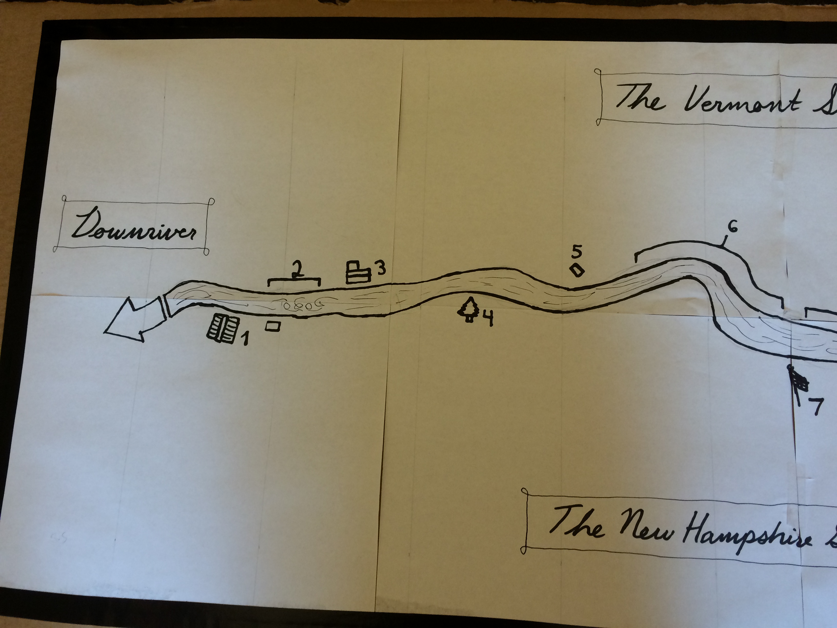
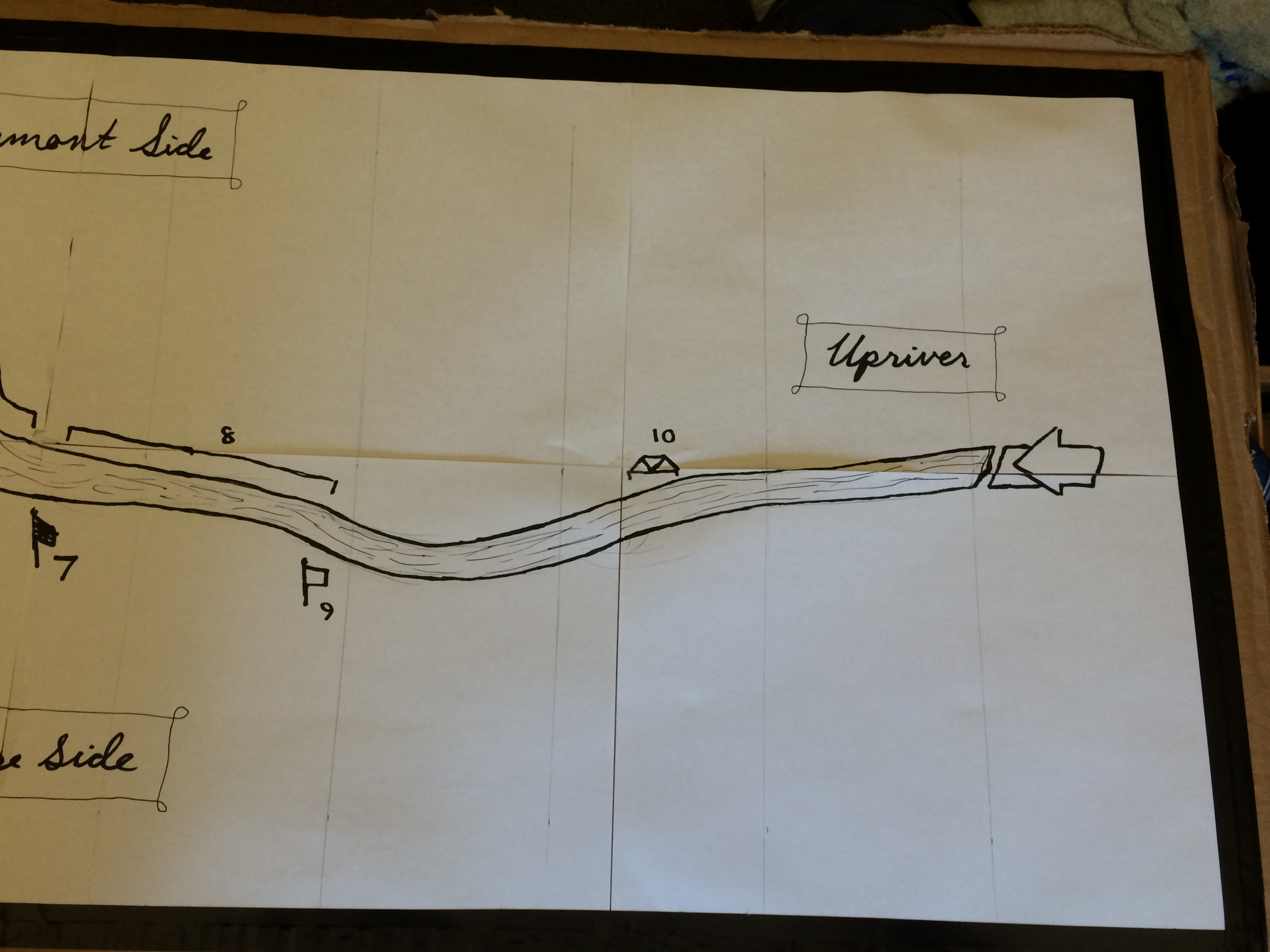
In a class discussion, I made the realization that the Connecticut River plays a very minimal, if any, role in the average Dartmouth student’s life. Most people know that the crew boathouse is down there, and so is Ledyard boathouse and dock (a great place to jump in the river to cool off on hot days), but that’s about it.
To me and about 100 other Dartmouth students, however, it is much more than that. It is just as much a part of our daily campus life as is The Green or Baker Library. It dominates our extracurricular life, almost every weekday of the year and many weekends as well. As my first year as a Dartmouth rower is coming to an end, I have developed, inevitably so, a good deal of intimate knowledge and experience of the river.
Rhetorical Goals
My primary rhetorical goal for this piece was to condense my year’s worth of experience on the river and translate it to my piece of cardboard, attempting to present the information in a way that is simple, casual, and easy for anyone to understand.
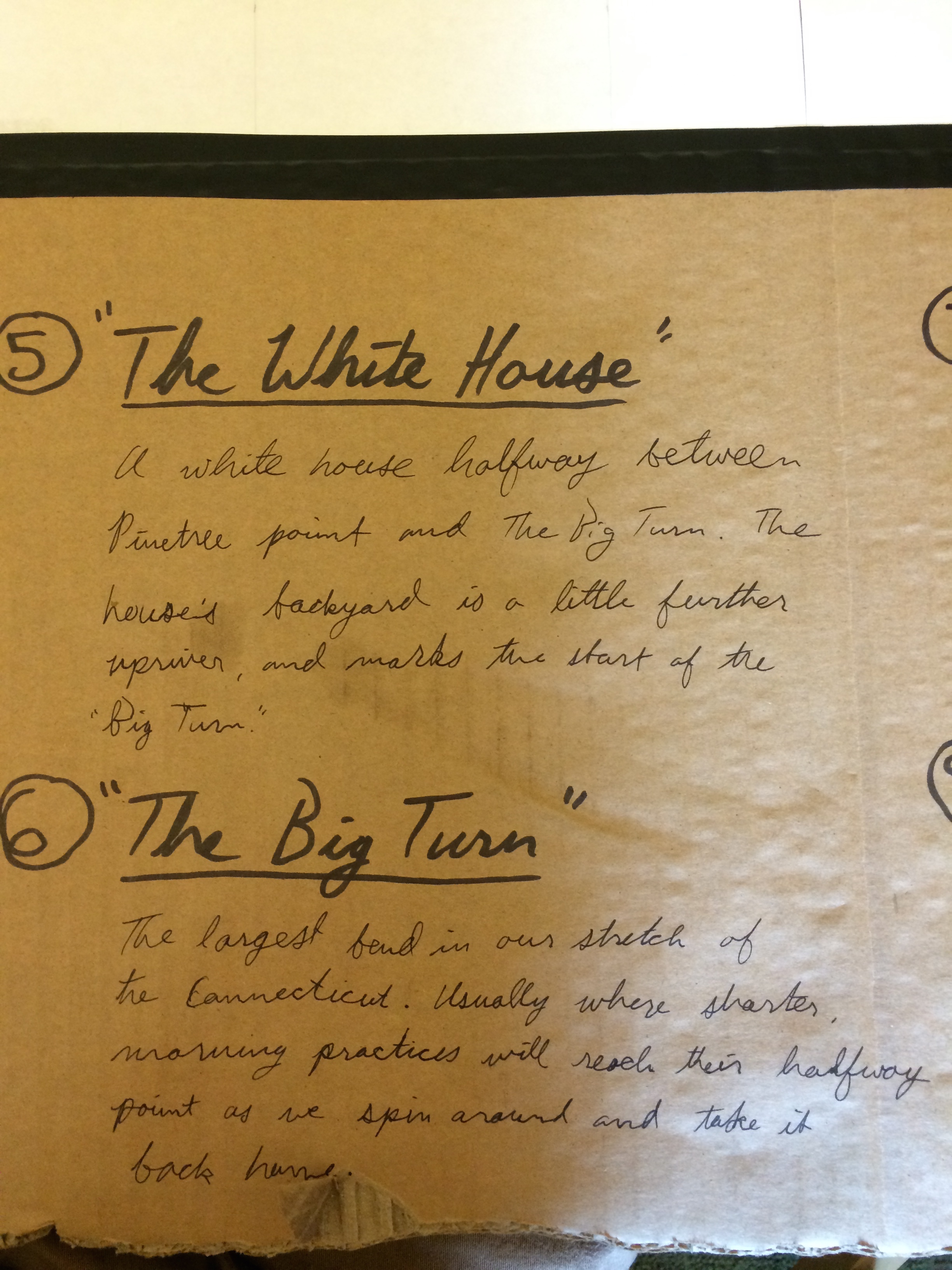
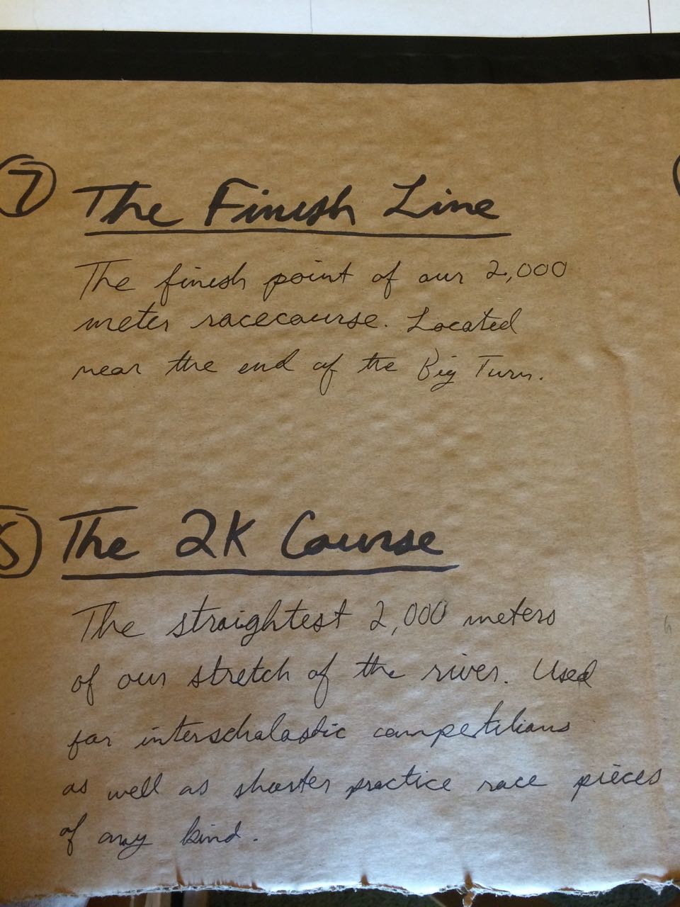
My original idea was to present the map and the numbered landmarks in a narrative style, bringing the reader through a typical rowing practice. I soon realized, however, that in no typical practice do we do we row past every one of the landmarks- at least not in the same way. As elements of narration are still present in my location descriptions, they are now more focused on their acquired meanings and connotations to myself and other Dartmouth rowers.
The Strengths (and Weaknesses) of my Map
A strength of my map is its simplicity and how it is (I think!) easy to understand. I wanted to keep the focus on the acquired meanings and connotations of the landmarks, and in doing so, I kept the map itself relatively minimalistic.
Perhaps a weakness of the map is its relative lack of usefulness as an actual navigational tool. While it was not my intention to make such a map, it still might have helped to have made the river and the included landmarks accurately to scale, in the correct North to South directional orientation, etc. Another weakness is aesthetic appearance. I thought the cardboard might be a practical way to make my map and give it a little character, but I think it looks a little messy.
How my Map Intersects with our Readings
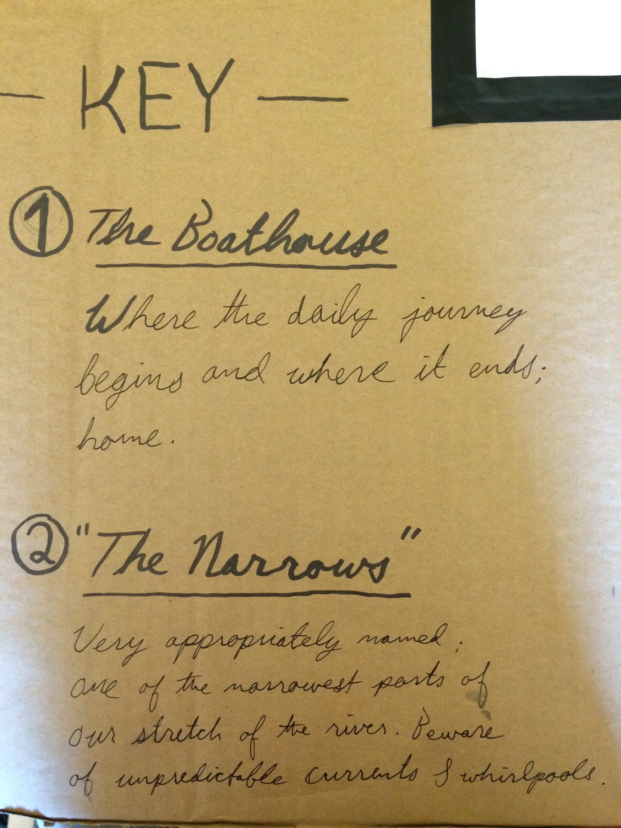
My map is quite similar to the Buddhist’s map of the world featured in Elkins’ “How to Look at a Map,” in that it is a heavily subjective map. In other words, the meanings I have assigned the landmarks I mentioned are very real and apparent to Dartmouth rowers (as were the holy sites to Buddhists), whereas the same places might hold little to no significance in the eyes of a typical Dartmouth student. For example, why would anyone have a reason to think that “The White House” is anything other than simply a white house? It is that to us too, but it is also a meeting point, a reference point, etc.