
By Elisabeth Pillsbury, Natalie Kwan, and Matt Kersey
Overview
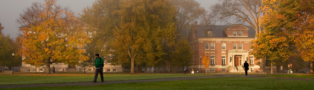
On a gorgeous Saturday morning in mid-May, our class embarked on a field trip to examine landscapes of rural poverty in Vermont. One of the difficulties of rural poverty is transportation and now the increasing disparity between the living and minimum wage, two issues we discussed at the Haven in White River Junction, Vermont. For example, in smaller, rural towns in New Hampshire and Vermont that are not populous enough to have their own high schools, there are no buses for students to take to reach schools in a nearby town. Thus, they have no choice but to discontinue their schooling after eighth grade. Individuals without a high school degree usually can make no more than the minimum wage, now significantly below the living wage. All of this adds to generational poverty, meaning poverty is cyclical mainly due to the fact that people are born into families where no one has been educated beyond a certain grade level.

The Connecticut River
To witness this for ourselves, we visited various towns in Vermont and primarily traveled on US Route 5, which follows the route of the Connecticut River. The Connecticut River is indispensable to this region because of its productive farmland and alluvial soils. Alluvial soils often exist in floodplains where the running water from the Connecticut River deposits. We started off at a town as close as Norwich (walking distance from Dartmouth College) and traveled as far as Springfield, about a 40-minute drive.
In the Fall of 2011, Vermont was a subject to the torrential downpour caused by tropical storm Irene. Flooding ensued, and many parts of the state’s infrastructure suffered extreme damage. Highways were washed away, meaning that entire towns were cut off from traditional means of supplies for several days. Farms, stores, and homes were covered with water and put out of commission for a long period of time. Additionally, many of Vermont’s cherished covered bridges were destroyed in the wake of the storm. Many of the places along this trail still bear the marks of Irene. It is important to remember this while visiting the towns and learning about the way of life maintained by these Vermont residents.
Norwich, VT
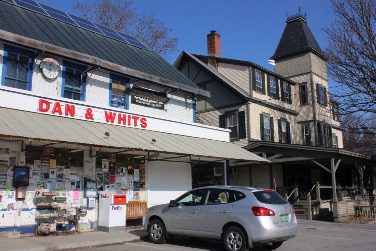
Dan & Whit’s on the left, the Norwich Inn on the right
We departed from the Hanover Inn in Hanover, NH and crossed the Ledyard Bridge, which separates Hanover, NH from Norwich, VT. There, we stopped by the Citgo Gas Station on Main Street, not to fill up on gas but rather to explore the over 100-year old general store, Dan & Whit’s. Dan & Whit’s epitomizes the “small business in a small town” feel characteristic of many areas in Vermont. Would Norwich have the same atmosphere if Dan & Whit’s was replaced by chain stores such as CVS or K-Mart?

A typical aisle in Dan & Whit’s
We encourage you go into Dan & Whit’s and see how far you have to walk to see the entire general store. It’s also worth noting who the cashiers are and what the workers tell you about the store and its appeal to local residents.
Look up and down Main Street and notice the plethora of expensive, well kept homes, showcasing Norwich’s standing as the town with the 6th highest income per capita in Vermont. Further, adjacent to Dan & Whit’s, as seen in the photo above, is the Norwich Inn, a popular stay for those visiting Dartmouth and the area.
White River Junction, VT
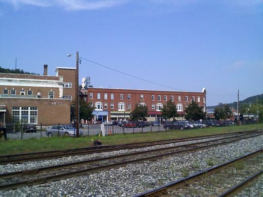
Looking across the railroad tracks towards Main Street in White River Junction

Main Street in White River Junction
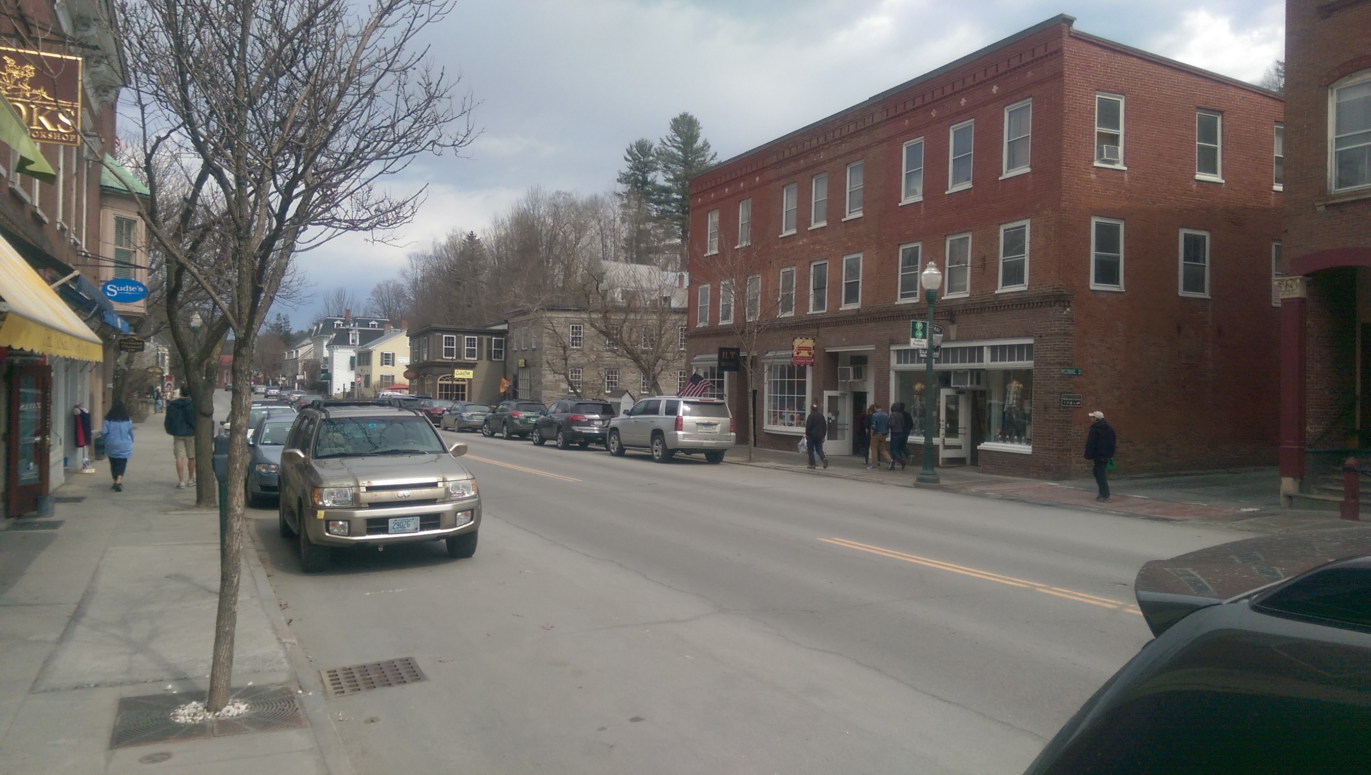
Travel south on US Route 5 for about five miles to reach White River Junction. White River Junction was one of the most important railroad communities from the 1840s to the 1960s. Built in a prime location at the junction of the White River and the Connecticut River, the town was embedded in the greater national geography of transportation and natural resources. Now, it is a shell of its former self partly due to the Interstate Highway System that was installed in the 1960s. Yet, there remain vestiges of the town from the 19th century, including the old mill buildings and the non-functioning, model train near the town’s railroad station. Take a look around at the types of buildings the town’s shops now occupy. What are they made of? What do they remind you of? Notice the number of thrift shops and the factory outlet malls indicative of the town’s decrease in affluence since the closing of the mills.
White River Junction is also now home to the VA Hospital which provides retraining and other services for veterans. Because the Hospital is one of the only ones in the area to provide free medical care and access services, some veterans must drive 6-7 hours to receive care!
Windsor, VT
A farmhouse along Route 4 in Windsor, VT
After leaving White River Junction, continue south on Route 5, which parallels Interstate 91 and the Connecticut River. This scenic route displays the classic New England landscape of old farmhouses, open fields and tree-covered hills. The Connecticut River has slowly cut through the glacial landscape of New Hampshire and Vermont creating a fertile, flat valley floor, ideal for farming. Think about what the farmers are growing and how that reflects the region and its climate. Also be aware that many of these farmers are taking their crops and other products and selling them at local farmers’ markets; this shows that what the farmers are growing is part of a larger system that meets the needs of local residents. Traveling along the Vermont side of the Connecticut River, steep hills rise up to the west and flat farmland spreads out to the east toward the river. Aside from the occasional small business such as a tractor repair shop or a farm stand, the only buildings to be seen are houses and barns. Two popular destinations in the town include the Harpoon Brewery and the Simon Pearce outlet – both a sharp contrast to the rural farmland that characterize the rest of the area. What do these say about the lives of the those working in Vermont as compared to the tourists who come to visit the brewery and outlet?
Springfield, VT

Mill buildings along the Black River Falls
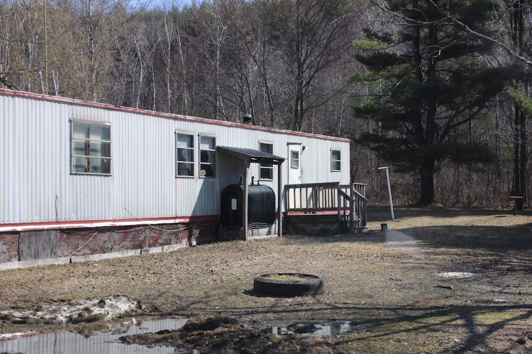
A trailer in the mobile home park
Travel on US-5 North for approximately twenty miles to reach Springfield, VT. On the outskirts of the town lies a driveway hidden from the road that leads to Windy Acres Hill Mobile Home Park. Many of the lawns were covered in toys, tarps, debris and chairs, suggesting that families with small children live in these mobile homes. This example of rural poverty juxtaposes with the recreational golf course across the street and any passerby who didn’t know that the Windy Acres Hill Mobile Home Park even existed would have trouble finding it. Springfield, VT is about a 35-minute drive from Norwich, VT, yet it is another world away. Reflect on how these homes compare to the buildings we saw dotting Main Street in Norwich.

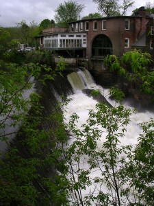
The Black River Falls
During WWII, Springfield was the 7th most likely area to be bombed in the United States because of its precision machinery industry. At the time, the mills in Springfield, powered by Black River Falls, housed quality precision machinery that supplied equipment for industrial hubs all over the United States. These mills created the different parts for the machinery in the factories during a time period that relied heavily on industrialization and the milling industry.
Springfield’s economy suffered after the mills shut down in the 1980s and now the town has the 152nd highest income in Vermont (as compared to Norwich’s 6th highest income rate).

A mural in Springfield
Yet, the continuing presence of elaborate, old mansions serve as a reminder of the social class divide when the mills were in full operation. Continue east from the Black River Falls and wind your way around Pleasant Street and Summer Hill Street, looking for examples of these luxurious homes. As you return back towards the falls, notice the housing for blue-collar workers alongside the river (with a high risk of flooding) in tightly packed apartments.
The Haven in White River Junction, VT

The Upper Valley Haven
Travel back to White River Junction via I-91 North (which parallels US-Route 5) for about thirty-six miles to visit the Upper Valley Haven, a non-profit organization fostering community and providing resources to those dealing with poverty. Not only does the Haven supply meals and clothing, but also offers shelter to community members for durations of up to nine months. Furthermore, the organization aims to guide its residents to success through educational programming and counseling. The Haven’s educational programs include those for children and those for adults. Children’s activities run a range of field trips and operate an after-school daycare. The Adult Learning has a Rental Program and Work Practice Program that teach its participants how to be financially independent and stable. The Haven relies completely on donations for its meals, including fresh produce from local farmers and grocery stores and leftover entrees from formal events. While eating our entirely donated meal, we spoke with the Executive Director and several residents about their experiences with the Haven and homelessness. Though working two part-time jobs that paid minimum wage ($7.25 per hour in New Hampshire), one resident relayed her struggle to earn a “livable wage” (~$16.00 per hour), the money needed for health insurance, clothing, transportation, food, and shelter.
An open door for all, the Haven has played an important role in countless lives in the Upper Valley. You can make a gift by mail, online, recurring donations, pledges, planning giving, and/or gifts of securities. Another gift you can give is your time, in the form of volunteer work. For more information, please visit their website where you can also access the online volunteer application.
Quechee, VT

Quechee Gorge
Falls in Quechee
From the Haven, continue west along Route 4 until you reach Quechee. This region’s identity is dominated by the gorge which runs through it and is a central piece to the town’s primary industry: tourism. Parking lots for gift shops, restaurants, and agencies aimed at the conservation and tourism of the area line both sides of the road on either end of the bridge spanning the gorge.
While in Quechee, consider what type of businesses you see around you and whom they might be serving. In doing this, its easy to get a sense of the town’s self-imposed identity as a tourism destination. Consider also the ways in which Irene may have affected the town. Although it is elevated far above the river and was spared the brunt of the destruction, its escape was not complete. The upscale Simon Pearce restaurant along the Ottauquechee River suffered the only significant loss of the town; the restaurant was washed away and subsequently rebuilt.
Woodstock, VT
Route 4 through Woodstock’s Center
Continuing on Route 4, you’ll pass a number of markers indicative of the affluence of many of the region’s inhabitants. Occasionally, the road borders golf courses and businesses clearly aimed at tourists (e.g. a large barn-turned store named “Scotland by the Yard”). This amalgam of countryside and commercial area gently yields to the town of Woodstock, aptly labeled by many as one of the most beautiful small towns in America. Its fame is largely a product of the Rockefellers’ influence during the 1890’s, when they constructed the Woodstock Inn and pumped money into the area to beautify the town. In doing this, they stipulated that no one had the legal right to change much about it. As a result, the town’s center is lined with large houses reminiscent of those one might have seen in another time. Storefronts and public buildings are built of brick and stone, marking their permanence and expensiveness (one had to import brick, as opposed to simply harvesting wood). As you pass through the town, what do you notice which might suggest wealth? What type of buildings surround the green? What type of businesses does the town have?
Houses in Woodstock
Cross the Connecticut River and follow a dirt road leading down to a small trailer park. This is in direct contrast to the most expensive houses located in the center of town. A couple miles away are the most expensive houses in Vermont, and here is a very visible indicator of poverty. The trailer park is located on a floodplain of the river and was subject to flooding during Irene. At this point, everything was lost and then rebuilt. As such, its buildings are, for the most part, relatively new, but there are still markers that suggest the area’s poverty. The roads are made from dirt and ill-maintained. The trailers look small and cramped. They’re obviously populated to a high degree by families. It is a stark contrast to Woodstock’s center.
Stockbridge, VT
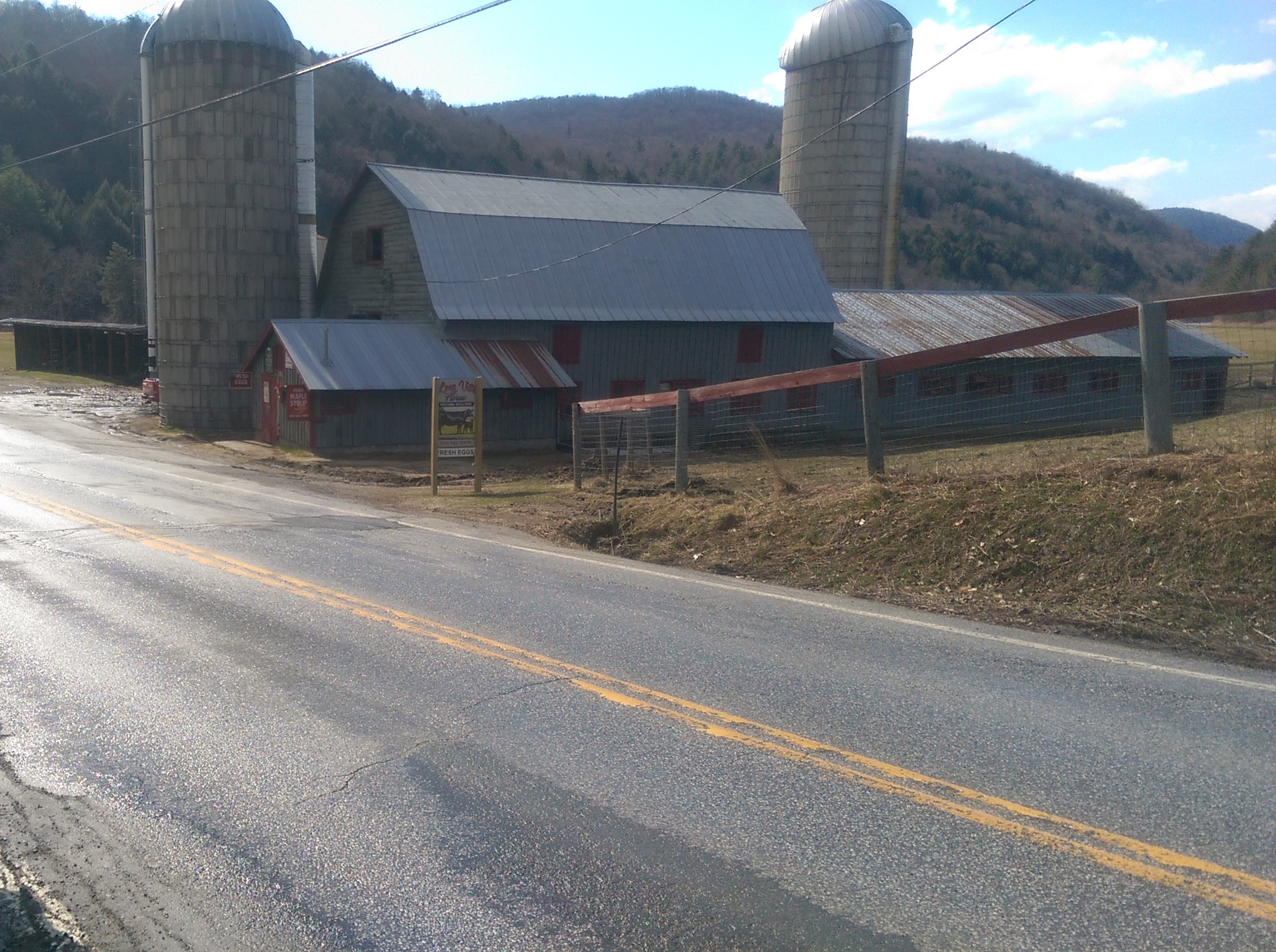
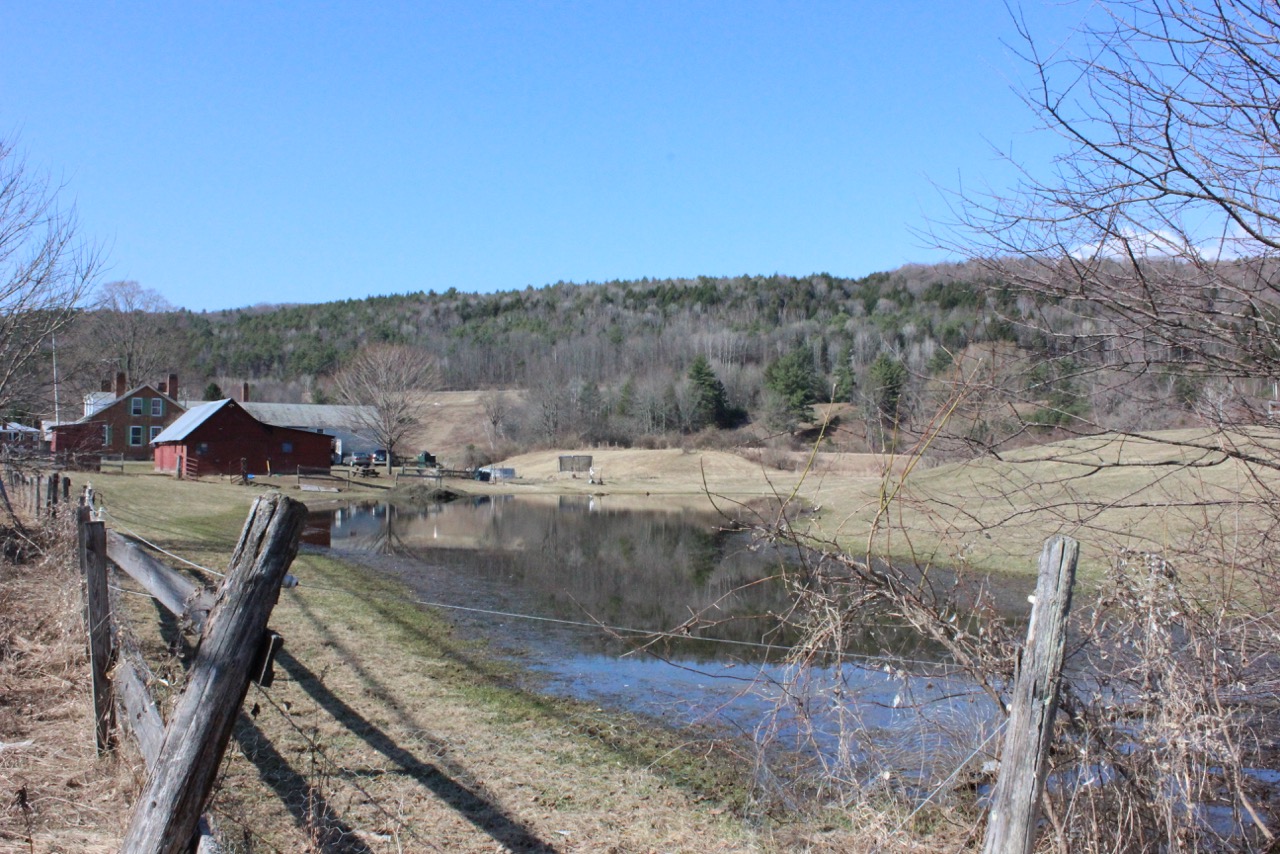
Farm at Stockbridge’s Center
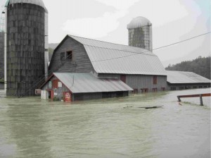
Stockbridge during Irene
After leaving the trailer park, make your way back to Woodstock’s center, travel up Vermont-12 and then west along 107 to Stockbridge. This is another area that bears the marks of Irene; 107, the route into the town, is newly paved following its collapse during the storm. Due to the highway’s proximity to the White River, the torrential downpour caused the earth underneath the road to erode, resulting in the town being almost completely cut off from the outside world for a period of time. The town is not particularly centralized but is loosely centered around a farm and Ford dealership located on a floodplain of the White River. Its location amplified Irene’s effects; the storm caused
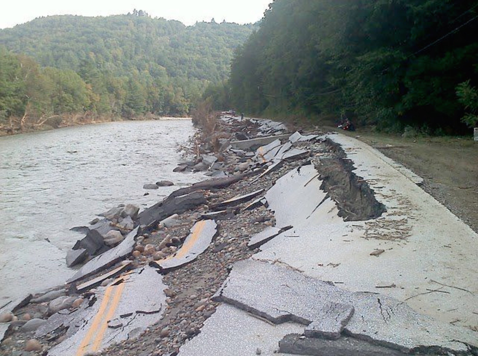
Route 107 after Irene
extensive damage to the farmland as well as to the barn itself. If you look closely, you can see a faint line on the barn’s sides marking where the water rose to during the storm.
The town is clearly less of a tourist attraction than Woodstock. Its primary industries lie in timber, syrup, and cattle farming. The population hovers at around 1000 and is comprised largely of older people.
Bethel, VT
Warehouses on Bethel’s Floodplain

Bethel’s Main Street
From Stockbridge, drive up 107 to its neighbor, Bethel, which boasts a population of almost five times that of Stockbridge. As a result, Bethel feels more like a traditional town; houses and businesses line the streets and are connected to the outside world by a set of train tracks that run through the town. This area was less affected by Irene than many of our other stops; the town itself was well above the area that flooded. This is a marker that suggests that the town is relatively well off; land above floodplains costs more than land on floodplains. This is the same issue that can be seen in Woodstock when comparing the town’s center to the trailer park outside. The primary damage that occurred only affected warehouses and homes that were lower in elevation. As a result, the type of poverty present in this region has a different character. While in the town, we passed several tenements which were, as our teacher’s assistant, Britta, informed us, operated in an almost slum-esque fashion. The poverty present there is pervasive, existing regardless of the flooding.
From here, it is a simple matter to get on I-89S and drive back to Norwich. The trip sets poverty and wealth in rural Vermont in vivid contrast. Sometimes mere miles separate the two. It’s often easier to see the wealth, which is more visible to tourists. The other side, however, lies not so far away. We encourage you to take the time to look beyond the surface and get a more complete understanding of the region’s story.